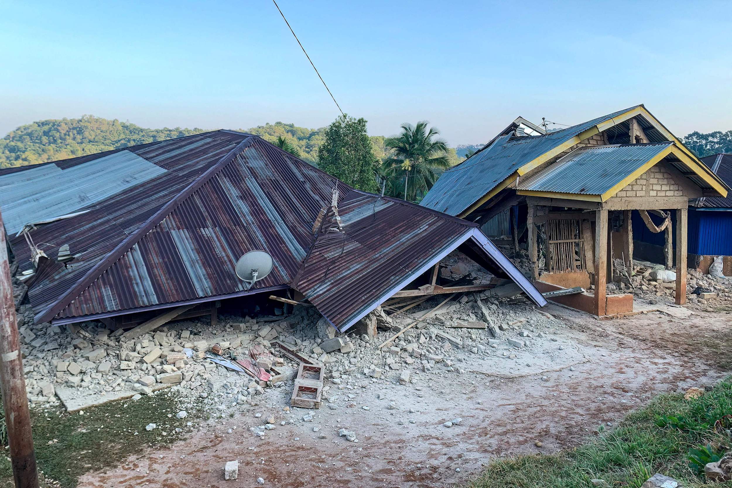
According to the China Earthquake Networks Center, a powerful 7.7-magnitude earthquake struck the waters near Indonesia’s Flores Island at 5:58 AM on August 15 (local time), with the epicenter located at 8.40 degrees south latitude and 121.40 degrees east longitude, at a depth of 20 kilometers.
Indonesian rescue authorities have confirmed that at least one person has died as a result of the quake so far. The Meteorology, Climatology, and Geophysical Agency has announced that the earlier tsunami early warning has been lifted.
Videos circulating on social media show buildings swaying violently and collapsing, rooms left in complete disarray, and residents desperately fleeing for safety. Some people captured footage of seawater receding dramatically from the shore.
Following the main tremor, multiple aftershocks above magnitude 5 have rattled the area near the epicenter. Among them, three quakes measuring 6.2 struck at 5:06 AM, 5:13 AM, and 5:28 AM local time respectively.
Ongoing aftershocks tend to compound the impact on building safety in the affected zone, complicate secondary disaster prevention, and disrupt daily life and public order. They also slow down post-disaster inspections, demolition of hazardous structures, and reconstruction efforts. Rescue and construction crews must constantly brace for sudden tremors, which significantly hampers the pace of recovery work.
The Chinese Consulate General in Denpasar has issued a notice advising Chinese citizens in the consular district to take precautions against earthquakes.In particular, tourists staying in the Labuan Bajo area of East Nusa Tenggara should remain highly alert, closely monitor local earthquake alertsand disaster prevention warnings, stay wary of aftershocks, and avoid the coastline. Anyone in need of assistance should promptly contact local police or reach out to the consulate for help.
Labuan Bajo, a well-known tourist town in East Nusa Tenggara Province, sits on the western coast of Flores Island and serves as the gateway to Komodo National Park.As the only major transit hub for travelers heading to this UNESCO World Heritage site, visitors can take boats from here to get up close with the world’s largest lizard — the Komodo dragon.
The surrounding waters boast one of the planet’s finest coral reef ecosystems and are a globally recognized diving hotspot. Last month, a Chinese couple was swept away by powerful waves while snorkeling near Komodo National Park. Police reported that the two had not been wearing life jackets and had no designated supervisor when they entered the water.
Indonesia sits along the Pacific Ring of Fire, at the junction of three major tectonic plates — the Eurasian Plate, the Indo-Australian Plate, and the Pacific Plate.These plates constantly grind against and collide with one another, making crustal activity extremely intense. The country experiences roughly 7,200 earthquakes of magnitude 3 or above each year, including about 2,300 at magnitude 4 or higher and around 263 at magnitude 5 or above.
On December 26, 2004, a massive 9.3-magnitude earthquake struck off the coast of Sumatra, Indonesia, at an extremely shallow depth. It remains the most powerful quake recorded in Indonesia since 1900. The energy released was equivalent to 23,000 Hiroshima atomic bombs detonating simultaneously.
That earthquake triggered a colossal tsunami that swept across the entire Indian Ocean rim, with waves reaching up to 30 meters high. The disaster claimed more than 230,000 lives across 14 countries, including Indonesia, Thailand, and Sri Lanka — with over 170,000 fatalities in Indonesia alone.